


- Home
- The Altamira cave
- Geology
Geology

The Altamira cave is located in the central region of Cantabria (northern Spain), on the borders of the municipalities of Santillana del Mar and Reocín.
Towards the north, the landscape is gentle, formed by small coastal mountain ranges, the lower stretch of the River Saja and the coastal plain. To the south, there is mountainous terrain and in the background, the Picos de Europa. A few kilometres away, there are other caves with human occupations and Upper Palaeolithic rock art, such as La Clotilde, Las Brujas, Las Aguas, El Linar and Cualventi, among others.
 Pulse para ampliar
 Pulse para ampliar
 Pulse para ampliar
 Pulse para ampliar
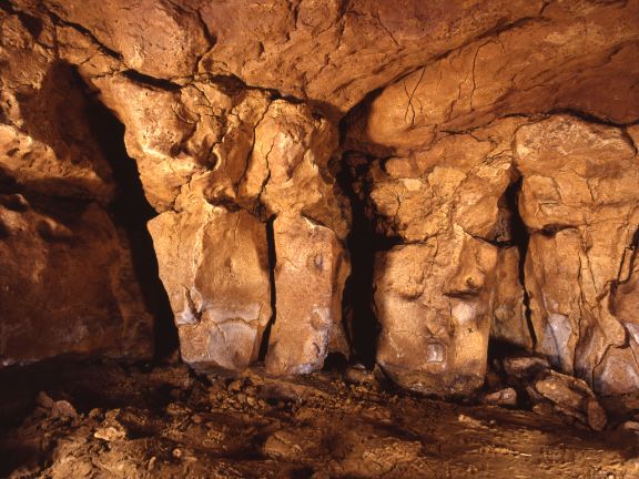
The Altamira cave is 158.5 metres above sea level, in the upper part of a karst of Pliocene origin. Its geological structure is formed by almost horizontal strata of calcarenites of up to one metre thick, separated by fine layers of clays. However, almost no signs remain of the circulation of subterranean water, as its formation is due to collapses of the ceiling and gravitational subsidence of the subsoil. The detachments occur in large blocks, which leave flat stigmas, trapezoidal sections and a floor formed by a chaos of collapsed blocks. One of these detachments blocked access to it 13 000 years ago by burying part of the entrance to the location of the dwelling settlements during the Palaeolithic.
Today, Altamira has an almost linear path of almost 290 metres in length. The entrance area is the location of the archaeological site and the polychrome room, both forming part of a large vestibular room. Further on, the longitudinal development of the cave leaves little room for large spaces, with the exception of the Great Hall, the only one with magnitudes of certain importance. It ends in a narrow gallery which, although difficult to access, also contains paintings and engravings like the rest of the cave.